Travel Hub
Plan a trip to Liberia

Liberia at a glance
Liberia is a country in Western Africa; its capital is Monrovia. People mainly speak English. The currency is the Liberian Dollar (LRD). VoyaKin maps 10 places to see here.
- Flag
- 🇱🇷
- Capital
- Monrovia
- Region
- Western Africa
- Languages
- English
- Currency
- Liberian Dollar (LRD)
- More
- Wikidata
Before you go: official information
Entry rules, visas and health requirements change. Confirm them with Liberia’s official immigration authority or its embassy before you book and again before you travel.
Check your own government’s travel advice before you go.
Places to see in Liberia
Descriptions from Wikipedia and photos from Wikimedia Commons, credited on each card.

Monrovia
City · Montserrado County
Monrovia is the capital and largest city of the African country of Liberia. Founded in 1822, it is located on Cape Mesurado on the Atlantic coast and, as of the 2022 census, had a population of 1,761,032 residents.
Text: Wikipedia (CC BY-SA 4.0). Photo: blk24ga (CC BY 3.0). Map

Gbarnga
City · Bong County
Gbarnga is the capital city of Bong County, Liberia, lying north east of Monrovia. During the First Liberian Civil War, it was the base for Charles Taylor's National Patriotic Front of Liberia. Cuttington College, a private, Episcopal-affiliated institution, is located near the town.
Text: Wikipedia (CC BY-SA 4.0). Photo: Jefferson Krua (CC BY-SA 4.0). Map
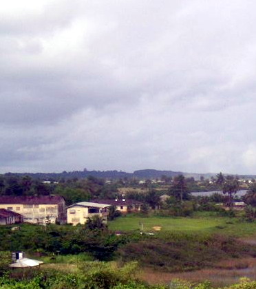
Harper
Town · Maryland County
Harper, situated on Cape Palmas, is the capital of Maryland County in Liberia. It is a coastal town situated between the Atlantic Ocean and the Hoffman River. Harper is Liberia's 11th largest town, with a population of 17,837.
Text: Wikipedia (CC BY-SA 4.0). Photo: Global Photographer (CC BY-SA 3.0). Map

Sapo National Park
Park & nature · Sinoe County
Sapo National Park is a national park in Sinoe County, Liberia.
Text: Wikipedia (CC BY-SA 4.0). Photo: Raimond Spekking (CC BY-SA 4.0). Map

Bushrod Island
Logan Town
Island · Montserrado County
Bushrod Island is an island near Monrovia, Liberia surrounded by the Atlantic Ocean, the Saint Paul River, the Mesurado River and Stockton Creek. It contains the Freeport of Monrovia, the major national port of Liberia and a variety of businesses.
Text: Wikipedia (CC BY-SA 4.0). Photo: Rjruiziii (CC BY-SA 3.0). Map

Lake Piso
Lake · Grand Cape Mount County
Lake Piso, also known as Lake Pisu and Fisherman's Lake, is an oblong tidal lagoon in Grand Cape Mount County in western Liberia, near the town of Robertsport. Its name originates from a local term meaning "pigeon's hole" – a reference to the flocks of pigeons that once came to Lake Piso for water.
Text: Wikipedia (CC BY-SA 4.0). Photo: Bethel. Anthony Chisom (CC BY-SA 4.0). Map

Providence Island
Island · Montserrado County
Providence Island was the site of the first successful settlement of American freedmen by the American Colonization Society in Liberia. It has been proposed as a UNESCO World Heritage Site by the government of Liberia.
Text: Wikipedia (CC BY-SA 4.0). Photo: Johnston, Harry Hamilton, Sir, 1858-1927, Royal Geographical Society (Great (Public domain). Map

Bensonville
Town · Montserrado County
Bensonville is the capital city of Montserrado County, Liberia. As of the 2008 national census, its population stood at 4,089. Bensonville is located 20 miles (32 km) away from the national capital, Monrovia, which is also located in Montserrado County.
Keep exploring
Also in Western Africa: Ghana · Senegal · Benin · Burkina Faso · Cape Verde · Côte d’Ivoire · Gambia · Guinea
Last updated November 12, 2026. Sources: Wikipedia (CC BY-SA 4.0), Wikimedia Commons, OpenStreetMap (ODbL). Partner offers below are separate from this guide and never change what’s written here.
Plan & book Liberia
Partner linksVoyaKin may earn a commission if you book through a partner link. It doesn’t change your price. How we work with partners
Flights
Kiwi.com
Search flights on Kiwi.com
Compare routes to and from this country.
Partner link. VoyaKin may earn a commission if you book through this link, at no extra cost to you.
Tours & experiences


Partner links via Viator. Ratings, reviews and prices come from Viator and may change. VoyaKin may earn a commission if you book through a partner link. It doesn’t change your price.
eSIM & staying connected
Saily
Stay connected: get an eSIM before you fly.
VoyaKin travelers get US$5 off their first Saily plan with code VOYAKIN9122.
VoyaKin readers’ code
Partner link. VoyaKin may earn a commission if you book through this link, at no extra cost to you.
Partner linksVoyaKin may earn a commission if you book through a partner link. It doesn’t change your price. How we work with partners