Travel Hub
Plan a trip to Aruba
Aruba at a glance
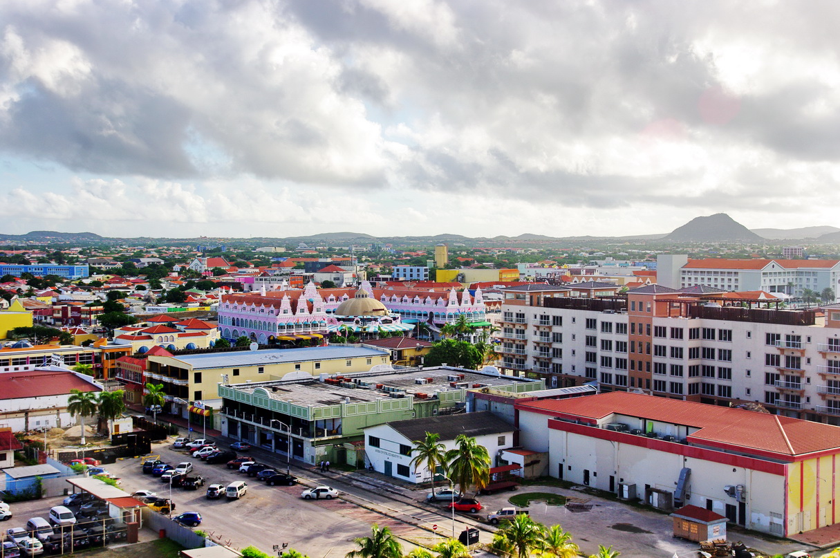
Aruba is a territory in Caribbean; its capital is Oranjestad. People mainly speak Dutch and Papiamento. The currency is the Aruban Florin (AWG). VoyaKin maps 20 places to see here.
- Flag
- 🇦🇼
- Capital
- Oranjestad
- Region
- Caribbean
- Languages
- Dutch, Papiamento
- Currency
- Aruban Florin (AWG)
- More
- Wikidata
Before you go: official information
Entry rules, visas and health requirements change. Confirm them with Aruba’s official immigration authority or its embassy before you book and again before you travel.
Check your own government’s travel advice before you go.
Places to see in Aruba
12 of the 20 places VoyaKin maps here. Descriptions from Wikipedia and photos from Wikimedia Commons, credited on each card.


San Nicolaas
City
San Nicolas is 19 kilometres (12 mi) southeast of Oranjestad, and is Aruba's second largest city. As of 2010 it has a population of 15,283, many of whom originate from the British Caribbean and the rest of the Caribbean.
Text: Wikipedia (CC BY-SA 4.0). Photo: Seagullbayaruba, Carlos Naranjo (CC BY-SA 4.0). Map


Hooiberg
Mountain
Hooiberg ) is a distinctively shaped, 165 m (541 ft) conical hill located at the heart of the island of Aruba. This geological formation is a prominent and recognizable landmark that has long captured the attention of locals and visitors alike—Hooiberg is Aruba's centerpiece.
Text: Wikipedia (CC BY-SA 4.0). Photo: Bjørn Christian Tørrissen (CC BY-SA 3.0). Map

Jamanota
Sero Jamanota
Mountain
Jamanota is a hill situated within Aruba's Arikok National Park, reaching a height of 188 metres (617 ft) and holding the distinction of being the highest point on the island.
Text: Wikipedia (CC BY-SA 4.0). Photo: Kashiunti-aua (CC0). Map

California Lighthouse
Lighthouse
The California Lighthouse, known by locals as Faro stands tall on a limestone plateau at Hudishibana, near Arashi Beach and Sasariwichi dunes on the northwestern tip of Aruba. It holds the distinction of being the tallest structure in Aruba.
Text: Wikipedia (CC BY-SA 4.0). Photo: Aruba Paradise Photos (CC BY-SA 4.0). Map

Palm Beach
Town
Palm Beach is a tourism district about 6 kilometers northwest of Oranjestad, the capital of Aruba.
Text: Wikipedia (CC BY-SA 4.0). Photo: Bjørn Christian Tørrissen (CC BY-SA 3.0). Map

Alto Vista Chapel
Religious
Alto Vista Chapel is a small Catholic chapel that stands on the hills above the north shore of the sea and to the northeast of the town of Noord, on the island of Aruba, 27 km north of the coast of Venezuela.
Text: Wikipedia (CC BY-SA 4.0). Photo: Erik Cleves Kristensen (CC BY 2.0). Map

Eagle Beach
Town
Eagle Beach is a beach and neighbourhood of Oranjestad, Aruba. The neighbourhood is famous for its many low-rise resorts and wide public beach. It is the widest beach of Aruba. and has soft white sand. It has been rated one of the best beaches in the world.
Text: Wikipedia (CC BY-SA 4.0). Photo: Rickzwart Rick Zwart (CC BY-SA 3.0). Map

Baby Beach
Beach
Baby Beach, officially known as Klein Lagoen, is a shallow, sheltered, man-altered lagoon in Aruba. It's in the Mangle Cora locality, near the village of Seroe Colorado, on the southwest side of the southeast end of the island.
Text: Wikipedia (CC BY-SA 4.0). Photo: Ginelly.Q (CC BY 4.0). Map

Fort Zoutman
Fort
Fort Zoutman is a military fortification at Oranjestad, Aruba.
Text: Wikipedia (CC BY-SA 4.0). Photo: JohnathanBaena (CC BY-SA 3.0). Map

National Archaeological Museum Aruba
National Archeological Museum Aruba
Ruins
The National Archaeological Museum Aruba is an archaeological museum in the city of Oranjestad in Aruba. The collections cover from 2500 BCE to the 19th century.
Text: Wikipedia (CC BY-SA 4.0). Photo: Natalie Liao Jen (CC BY-SA 3.0). Map


Keep exploring
Also in Caribbean: Jamaica · Dominican Republic · Barbados · Bahamas · Anguilla · Antigua & Barbuda · British Virgin Islands · Caribbean Netherlands
Last updated November 12, 2026. Sources: Wikipedia (CC BY-SA 4.0), Wikimedia Commons, OpenStreetMap (ODbL). Partner offers below are separate from this guide and never change what’s written here.
Plan & book Aruba
Partner linksVoyaKin may earn a commission if you book through a partner link. It doesn’t change your price. How we work with partners
Flights
Kiwi.com
Search flights on Kiwi.com
Compare routes to and from this country.
Partner link. VoyaKin may earn a commission if you book through this link, at no extra cost to you.
Tours & experiences
 3 h–6 hLuxury Private Yacht Charter Aruba 5.0 (255)From US$2,399 on Viator
 4 hAruba Small-Group UTV Adventure|Private Off-Road Tour Max 4 UTVs 5.0 (190)From US$256 on Viator
 4 hPrivate Aruba National Park Hiking & Natural Pool Swimming 5.0 (167)From US$60 on Viator
 2 hPrivate Snorkeling Aruba: FIN-TASTIC Turtle Spotting 5.0 (137)From US$90 on Viator
 4 hPrivate Aruba Jeep Adventure|Custom Island Tour with Local Guide 5.0 (55)From US$500 on Viator
 2.5 hGuided Padi Discover Scuba Diving for Non-Certified Divers 5.0 (54)From US$120 on Viator
 4 hPrivate 4x4 Natural Pool, Caves & Baby Beach by Cross Aruba Tours 5.0 (46)From US$600 on Viator
 3 h–4 hEpic Off-Road Surron Electric Bike Tour in Aruba 5.0 (43)From US$160 on Viator
 4 h–6 hAruba Island Private Jeep Tour Arikok Park & Baby beach 5.0 (43)From US$800 on Viator
 4 h–5 hHalf Day Hike at Arikok National Park & Snorkel 5.0 (41)From US$115 on Viator
Partner links via Viator. Ratings, reviews and prices come from Viator and may change. VoyaKin may earn a commission if you book through a partner link. It doesn’t change your price.
eSIM & staying connected
Saily
Stay connected: get an eSIM before you fly.
VoyaKin travelers get US$5 off their first Saily plan with code VOYAKIN9122.
VoyaKin readers’ code
Partner link. VoyaKin may earn a commission if you book through this link, at no extra cost to you.
Partner linksVoyaKin may earn a commission if you book through a partner link. It doesn’t change your price. How we work with partners