Travel Hub
Plan a trip to Antigua & Barbuda

Antigua & Barbuda at a glance
Antigua & Barbuda is a country in Caribbean. People mainly speak English. The currency is the East Caribbean Dollar (XCD). VoyaKin maps 20 places to see here, including 3 UNESCO World Heritage sites.
- Flag
- 🇦🇬
- Region
- Caribbean
- Languages
- English
- Currency
- East Caribbean Dollar (XCD)
- More
- Wikidata
Before you go: official information
Entry rules, visas and health requirements change. Confirm them with Antigua & Barbuda’s official immigration authority or its embassy before you book and again before you travel.
Check your own government’s travel advice before you go.
Places to see in Antigua & Barbuda
12 of the 20 places VoyaKin maps here. Descriptions from Wikipedia and photos from Wikimedia Commons, credited on each card.

Nelson's DockyardUNESCO
Nelson's Dockyards National Park
Museum · Saint Paul
Nelson's Dockyard is a cultural heritage site and marina in English Harbour, located in Saint Paul on the Caribbean island of Antigua, in Antigua and Barbuda. It is the only continuously working Georgian era dockyard in the world.
Text: Wikipedia (CC BY-SA 4.0). Photo: Dr. Thomas Liptak (CC BY 4.0). Map

Antigua Naval Dockyard and Related Archaeological SitesUNESCO
Landmark · Saint Paul
The Antigua Naval Dockyard and Related Archaeological Sites is a 255 ha UNESCO World Heritage Site in Saint Paul, Antigua, Antigua and Barbuda. It constitutes a collection of Georgian era naval structures, namely a naval dockyard and related supporting compounds.
Text: Wikipedia (CC BY-SA 4.0). Photo: Tomhennigan (Public domain). Map

Clarence HouseUNESCO
Heritage site · Saint Paul
Clarence House is a museum in the Ordnance Bay neighbourhood of English Harbour. It is one of the Antigua Naval Dockyard and Related Archaeological Sites, a UNSECO World Heritage Site.
Text: Wikipedia (CC BY-SA 4.0). Photo: John R. Anjo (Public domain). Map

St. John's
Town · Saint John
St. John's is the largest city in Antigua and Barbuda. It is located in the western part of Antigua, surrounding St. John's Harbour. It is the main city of the Central Plain region. The city is Antigua and Barbuda's primate city, having a population of 22,219. St.
Text: Wikipedia (CC BY-SA 4.0). Photo: This image or media was taken or created by Matt H (CC BY-SA 3.0). Map

Antigua
Island · Antigua
Antigua is an island in the Lesser Antilles. It is one of the Leeward Islands in the Caribbean region and the most populous island of the country of Antigua and Barbuda. Antigua and Barbuda became an independent state within the Commonwealth of Nations on 1 November 1981.
Text: Wikipedia (CC BY-SA 4.0). Photo: Calyponte (CC BY-SA 3.0). Map
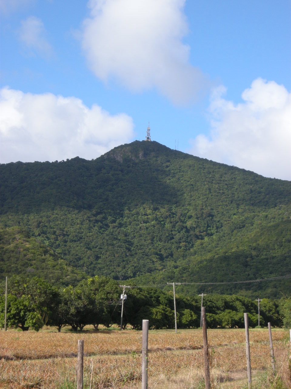
Boggy Peak
Mountain · Saint Mary
Boggy Peak is a mountain located in the southwest of Antigua, a constituent island of the archipelagic country of Antigua and Barbuda. At a height of 1,319 feet (402 m), it is the highest point of the Shekerley Mountains and the island as a whole.
Text: Wikipedia (CC BY-SA 4.0). Photo: dearinaima (CC BY 3.0). Map

Codrington
Town · Barbuda
Codrington is the only village on the island of Barbuda, which is part of the country of Antigua and Barbuda. Codrington coincides with the Codrington major division, one of the two major divisions on Barbuda. Situated on the Codrington Lagoon, Codrington is the country's northernmost settlement.
Text: Wikipedia (CC BY-SA 4.0). Photo: Wikimedia Commons: Barbuda ISS008-E-7945.jpg (Public domain). Map

Long Island
Island · Antigua
Long Island, also known as Jumby Bay, is a private island off the northeast coast of Antigua. It is located off the northern tip of the Crabbs Peninsula, about 2.5 kilometres (1.6 mi) from Dutchman Bay on Antigua. It is the fifth-largest island of Antigua and Barbuda.
Text: Wikipedia (CC BY-SA 4.0). Photo: CROIX (CC BY-SA 4.0). Map


St. John's Cathedral
Religious · Saint John
St. John's Cathedral also known as the Cathedral of St. John the Divine, the Cathedral Church of the Diocese of North Eastern Caribbean and Aruba, is an Anglican church perched on a hilltop in St. John's, Antigua and Barbuda.
Text: Wikipedia (CC BY-SA 4.0). Photo: D'Arcy Norman (CC BY 2.0). Map

Guiana Island
Island · Antigua
Guiana Island, or Guana Island, is an island off the northeast coast of Antigua, between the Parham Peninsula and Crump Island. It forms the southern coast of the North Sound, and is the fourth largest island of Antigua and Barbuda. The 2011 census recorded a permanent population of 0.
Text: Wikipedia (CC BY-SA 4.0). Photo: CROIX (CC BY-SA 4.0). Map

Prickly Pear Island
Island · Antigua
Prickly Pear Island is an islet approximately 650 metres off the north shore coast of Hodges Bay on the much larger island of Antigua, West Indies.
Text: Wikipedia (CC BY-SA 4.0). Photo: Commander Keane, Legis (talk - contribs) The original uploader wa (Public domain). Map


Keep exploring
Also in Caribbean: Jamaica · Dominican Republic · Barbados · Bahamas · Anguilla · Aruba · British Virgin Islands · Caribbean Netherlands
Last updated November 12, 2026. Sources: Wikipedia (CC BY-SA 4.0), Wikimedia Commons, OpenStreetMap (ODbL). Partner offers below are separate from this guide and never change what’s written here.
Plan & book Antigua & Barbuda
Partner linksVoyaKin may earn a commission if you book through a partner link. It doesn’t change your price. How we work with partners
Flights
Kiwi.com
Search flights on Kiwi.com
Compare routes to and from this country.
Partner link. VoyaKin may earn a commission if you book through this link, at no extra cost to you.
eSIM & staying connected
Saily
Stay connected: get an eSIM before you fly.
VoyaKin travelers get US$5 off their first Saily plan with code VOYAKIN9122.
VoyaKin readers’ code
Partner link. VoyaKin may earn a commission if you book through this link, at no extra cost to you.
Partner linksVoyaKin may earn a commission if you book through a partner link. It doesn’t change your price. How we work with partners