Travel Hub
Plan a trip to American Samoa

American Samoa at a glance
American Samoa is a territory in Polynesia; its capital is Pago Pago. People mainly speak Samoan and English. The currency is the US Dollar (USD). VoyaKin maps 12 places to see here.
- Flag
- 🇦🇸
- Capital
- Pago Pago
- Region
- Polynesia
- Languages
- Samoan, English
- Currency
- US Dollar (USD)
- More
- Wikidata
Before you go: official information
Entry rules, visas and health requirements change. Confirm them with American Samoa’s official immigration authority or its embassy before you book and again before you travel.
Check your own government’s travel advice before you go.
Places to see in American Samoa
Descriptions from Wikipedia and photos from Wikimedia Commons, credited on each card.

Tutuila
Island · American Samoa
Tutuila is the largest and most populous island of American Samoa and is part of the archipelago of the Samoan Islands. It is the third largest island in the Samoan Islands chain of the Central Pacific.
Text: Wikipedia (CC BY-SA 4.0). Photo: Tavita Togia, National Park Service (Public domain). Map


Aunuʻu
Island · American Samoa
Aunuʻu is a small volcanic island off the southeastern shore of Tutuila in Saʻole County, American Samoa. It has a land area of 374.83 acres, and a 2010 census population of 436 persons. Politically, it is a part of the Eastern District, one of the two primary political divisions of American Samoa.
Text: Wikipedia (CC BY-SA 4.0). Photo: Wikimedia Commons: Aunu'u Island National National Landmark.jpg (Public domain). Map
Aʻasu
A'asu
Town · American Samoa
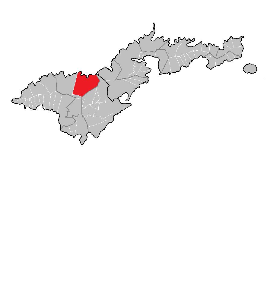
Aʻasu or Āsu is a village on the north coast of Tutuila Island, American Samoa. It is located to the west of Fagasa and northwest of Pago Pago. It is one of multiple villages involved in an archaeological survey of the island.
Text: Wikipedia (CC BY-SA 4.0). Photo: Geofix (CC BY-SA 3.0). Map

Pola Island
Island · American Samoa
Pola Island is an island just offshore from the village of Vatia on Tutuila Island in American Samoa. It is also known as Cockscomb. Pola Island is designated as part of the National Park American Samoa and is a popular tourist attraction.
Text: Wikipedia (CC BY-SA 4.0). Photo: Fatumafuti (CC BY-SA 4.0). Map

Rainmaker Mountain
North Pioa Mountain
Mountain · American Samoa
Rainmaker Mountain is the name of a mountain located near Pago Pago, American Samoa on Tutuila Island. Rainmaker Mountain traps rain clouds and gives Pago Pago the highest annual rainfall of any harbor. The average annual rainfall on the mountain is around 200 inches (510 cm).
Text: Wikipedia (CC BY-SA 4.0). Photo: NPS (Public domain). Map

Matafao Peak
Mountain · American Samoa
Matafao Peak is a mountain in American Samoa, on the island of Tutuila. With an elevation of 2,142 feet (653 m), it is the highest peak on Tutuila Island. The mountain, like Rainmaker Mountain across Pago Pago Harbor, is a remnant of a volcanic plug and is part of the volcanic origins of the island.
Text: Wikipedia (CC BY-SA 4.0). Photo: Wikimedia Commons: Matafao Peak National Natural Landmark.jpg (Public domain). Map

Jean P. Haydon Museum
Navy Building 43 (Commissary Store)
Park & nature · American Samoa
The Jean P. Haydon Museum is a museum in Pago Pago dedicated to the culture and history of the United States territory of American Samoa. It contains a collection of canoes, coconut-shell combs, pigs’ tusk armlets and native pharmacopoeia.
Text: Wikipedia (CC BY-SA 4.0). Photo: Fogāmaa (CC BY-SA 4.0). Map

Rose Island Concrete Monument
Park & nature · American Samoa
The Rose Island Concrete Monument is a historic commemorative marker on Rose Island, part of Rose Atoll, a remote island located in the far eastern reaches of the territorial waters of American Samoa.
Text: Wikipedia (CC BY-SA 4.0). Photo: US Government (FWS or NPS) employee (Public domain). Map


Keep exploring
Also in Polynesia: Cook Islands · French Polynesia · Niue · Pitcairn Islands · Samoa · Tokelau · Tonga · Tuvalu
Last updated November 12, 2026. Sources: Wikipedia (CC BY-SA 4.0), Wikimedia Commons, OpenStreetMap (ODbL). Partner offers below are separate from this guide and never change what’s written here.
Plan & book American Samoa
Partner linksVoyaKin may earn a commission if you book through a partner link. It doesn’t change your price. How we work with partners
Flights
Kiwi.com
Search flights on Kiwi.com
Compare routes to and from this country.
Partner link. VoyaKin may earn a commission if you book through this link, at no extra cost to you.
eSIM & staying connected
Saily
Stay connected: get an eSIM before you fly.
VoyaKin travelers get US$5 off their first Saily plan with code VOYAKIN9122.
VoyaKin readers’ code
Partner link. VoyaKin may earn a commission if you book through this link, at no extra cost to you.
Partner linksVoyaKin may earn a commission if you book through a partner link. It doesn’t change your price. How we work with partners