Travel Hub
Plan a trip to Timor-Leste
Timor-Leste at a glance
Timor-Leste is a country in Southeast Asia; its capital is Dili. People mainly speak Portuguese and Tetum. The currency is the US Dollar (USD). VoyaKin maps 18 places to see here.
- Flag
- 🇹🇱
- Capital
- Dili
- Region
- Southeast Asia
- Languages
- Portuguese, Tetum
- Currency
- US Dollar (USD)
- More
- Wikidata
Before you go: official information
Entry rules, visas and health requirements change. Confirm them with Timor-Leste’s official immigration authority or its embassy before you book and again before you travel.
Check your own government’s travel advice before you go.
Places to see in Timor-Leste
12 of the 18 places VoyaKin maps here. Descriptions from Wikipedia and photos from Wikimedia Commons, credited on each card.

Dili
City · Dili Municipality
Dili is the capital and largest city of Timor-Leste. It lies on the northern coast of the island of Timor, in a small area of flat land hemmed in by mountains. The climate is tropical with distinct wet and dry seasons.
Text: Wikipedia (CC BY-SA 4.0). Photo: Jose Fernando Real (CC BY-SA 4.0). Map

Timor
Island · East Nusa Tenggara
Timor is an island at the southern end of Maritime Southeast Asia, in the north of the Timor Sea. The name is a variant of timur, Malay for "east"; it is so called because it lies at the eastern end of the Lesser Sunda Islands. Mainland Australia is less than 500 km away, separated by the Timor Sea.
Text: Wikipedia (CC BY-SA 4.0). Photo: Wikimedia Commons: Timor island2.jpg (Public domain). Map

Baucau
Town · Baucau Municipality
Baucau is the second-largest city in Timor-Leste, after Dili, the capital, which lies 122 km (76 mi) to its west.
Text: Wikipedia (CC BY-SA 4.0). Photo: David Stanley (CC BY 2.0). Map

Tatamailau
Mountain · Ermera Municipality
Tatamailau, or Tata Mailau, also Mount Ramelau, is the highest point in Timor-Leste and also of Timor island at 2,963 m (9,721 ft). The mountain is located approximately 70 km (43 mi) south of the capital Dili in the district of Ainaro.
Text: Wikipedia (CC BY-SA 4.0). Photo: Colin Trainor (CC BY-SA 3.0). Map

Jaco Island
Island · Lautém Municipality
Jaco Island is an uninhabited island in Timor-Leste, a country occupying the eastern end of the island of Timor in the Lesser Sunda Islands in Southeast Asia. It lies off the eastern tip with Cape Cutcha of the island of Timor.
Text: Wikipedia (CC BY-SA 4.0). Photo: Andidut (CC BY-SA 3.0). Map

Lospalos
Town · Lautém Municipality
Lospalos is a city in Timor-Leste, 248 kilometres (154 mi) to the east of Dili, the national capital. Lospalos has a population of 17,186 (2006) and is the capital of Lautém Municipality and the Lospalos Administrative Post. The subdistrict has a population of 25,417 (2004).
Text: Wikipedia (CC BY-SA 4.0). Photo: J. Patrick Fischer (CC BY 2.5). Map

Aileu
Town · Aileu municipality
Aileu is a city in Aileu District, Timor-Leste. It is located 47 km (29 mi) southwest of Dili, the national capital, and had a population of 2,788 in 2015.
Text: Wikipedia (CC BY-SA 4.0). Photo: David Stanley (CC BY 2.0). Map

Immaculate Conception Cathedral
Igreza Catedral da Imaculada Conceição (Díli)
Religious · Dili Municipality
The Immaculate Conception Metropolitan Cathedral in Dili is the main church of the Roman Catholic Archdiocese of Dili, Timor-Leste.
Text: Wikipedia (CC BY-SA 4.0). Photo: Bahnfrend (CC BY-SA 4.0). Map
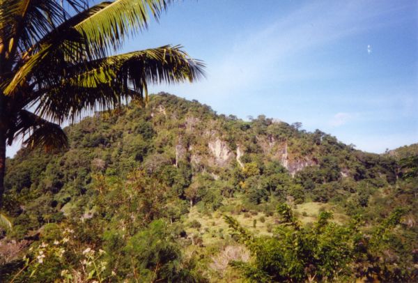
Nino Konis Santana National Park
Parke Nasionál Nino Konis Santana
Park & nature · Lautém
Nino Konis Santana National Park (Portuguese: Parque Nacional Nino Konis Santana; Tetum: Parke Nasionál Nino Konis Santa) is Timor-Leste's first national park. The park, established on 15 August 2007, covers 1,236 square kilometres (477 sq mi).
Text: Wikipedia (CC BY-SA 4.0). Photo: J. Patrick Fischer (CC BY 3.0). Map

An-Nur Mosque
Mesquita An-Nur
Religious · Dili Municipality
The An-Nur Mosque is a mosque in Alor Village, Dili, Timor-Leste.
Text: Wikipedia (CC BY-SA 4.0). Photo: Ludwig Müller (CC BY-SA 4.0). Map

Pura Girinatha
Religious · Dili Municipality
Pura Girinatha is the largest Balinese Hindu temple in Timor-Leste. It is located in the quarter Taibesi, in the south of the capital city of Dili, near the local market. The temple is located on a small hill outside the city center, but is accessible by car.
Text: Wikipedia (CC BY-SA 4.0). Photo: José Fernando Real (CC BY-SA 4.0). Map

Motael Church
Igreja de Santo António de Motael
Religious · Dili Municipality
The Church of Santo António de Motael is the oldest Roman Catholic church in Timor-Leste and is located in Dili, the country's capital city. It is dedicated to Anthony of Padua. While the first church at this location was built around 1800, the current building dates back to 1955.
Text: Wikipedia (CC BY-SA 4.0). Photo: David Stanley from Nanaimo, Canada (CC BY 2.0). Map


Keep exploring
Also in Southeast Asia: Vietnam · Thailand · Philippines · Brunei · Cambodia · Indonesia · Laos · Malaysia
Last updated November 12, 2026. Sources: Wikipedia (CC BY-SA 4.0), Wikimedia Commons, OpenStreetMap (ODbL). Partner offers below are separate from this guide and never change what’s written here.
Plan & book Timor-Leste
Partner linksVoyaKin may earn a commission if you book through a partner link. It doesn’t change your price. How we work with partners
Flights
Kiwi.com
Search flights on Kiwi.com
Compare routes to and from this country.
Partner link. VoyaKin may earn a commission if you book through this link, at no extra cost to you.
eSIM & staying connected
Saily
Stay connected: get an eSIM before you fly.
VoyaKin travelers get US$5 off their first Saily plan with code VOYAKIN9122.
VoyaKin readers’ code
Partner link. VoyaKin may earn a commission if you book through this link, at no extra cost to you.
Partner linksVoyaKin may earn a commission if you book through a partner link. It doesn’t change your price. How we work with partners