Travel Hub
Plan a trip to Namibia
Namibia at a glance
Namibia is a country in Southern Africa; its capital is Windhoek. People mainly speak English. The currency is the Namibian Dollar (NAD). VoyaKin maps 20 places to see here, including 1 UNESCO World Heritage site.
- Flag
- 🇳🇦
- Capital
- Windhoek
- Region
- Southern Africa
- Languages
- English
- Currency
- Namibian Dollar (NAD)
- More
- Wikidata
Before you go: official information
Entry rules, visas and health requirements change. Confirm them with Namibia’s official immigration authority or its embassy before you book and again before you travel.
Check your own government’s travel advice before you go.
Places to see in Namibia
12 of the 20 places VoyaKin maps here. Descriptions from Wikipedia and photos from Wikimedia Commons, credited on each card.

TwyfelfonteinUNESCO
Ruins · Kunene Region
Twyfelfontein, officially known as ǀUi-ǁAis, is a site of ancient rock engravings in the Kunene Region of north-western Namibia. It consists of a spring in a valley flanked by the slopes of a sandstone table mountain that receives very little rainfall and has a wide range of diurnal temperatures.
Text: Wikipedia (CC BY-SA 4.0). Photo: Thomas Schoch (CC BY-SA 3.0). Map

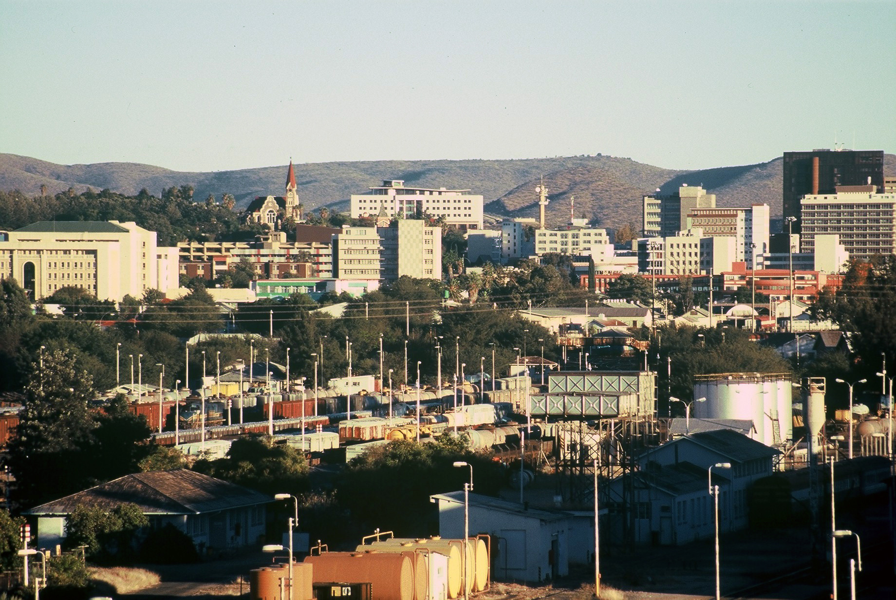
Windhoek
City · Khomas Region
Windhoek is the capital and largest city of Namibia. It is located in central Namibia on the Khomas Highland plateau area, at around 1,700 m (5,600 ft) above sea level in the geographical centre of the country.
Text: Wikipedia (CC BY-SA 4.0). Photo: Bries (CC BY-SA 2.5). Map

Walvis Bay
City · Erongo Region
Walvis Bay is a city in Namibia and the name of the bay on which it lies. It is the second largest city in Namibia and the largest coastal city in the country. The city covers an area of 29 square kilometres (11 sq mi) of land.
Text: Wikipedia (CC BY-SA 4.0). Photo: Digr (CC BY-SA 4.0). Map

Swakopmund
City · Erongo Region
Swakopmund is a city on the coast of western Namibia, 352 km (219 mi) west of the Namibian capital Windhoek via the B2 main road. It is the capital of the Erongo administrative district. It had 75,921 inhabitants in 2023.
Text: Wikipedia (CC BY-SA 4.0). Photo: Brian McMorrow (CC BY-SA 2.5). Map

Hoba meteorite
Landmark · Otjozondjupa Region
The Hoba meteorite is named after the farm Hoba West, where it lies, not far from Grootfontein, in the Otjozondjupa Region of Namibia. It has been uncovered, but because of its large mass, has never been moved from where it fell. The main mass is estimated at more than 60 tonnes.
Text: Wikipedia (CC BY-SA 4.0). Photo: Eugen Zibiso (CC BY 2.0). Map

Lüderitz
Town · Karas Region
Lüderitz is a town in the ǁKaras Region of southern Namibia. It lies on one of the least hospitable coasts in Africa. It is a port developed around Robert Harbour and Shark Island. Lüderitz had a population of 16,125 people in 2023.
Text: Wikipedia (CC BY-SA 4.0). Photo: Harald Süpfle (CC BY-SA 2.5). Map

Etosha National Park
Park & nature · Oshana Region
Etosha National Park is a national park in northwestern Namibia and one of the largest national parks in Africa. It was proclaimed a game reserve in March 1907 in Ordinance 88 by the Governor of German South West Africa, Friedrich von Lindequist.
Text: Wikipedia (CC BY-SA 4.0). Photo: Thomas Schoch (CC BY-SA 3.0). Map

Namib-Naukluft National Park
Park & nature
The Namib-Naukluft National Park is a national park in western Namibia, situated between the coast of the Atlantic Ocean and the edge of the Great Escarpment. It encompasses part of the Namib Desert, the Naukluft mountain range, and the lagoon at Sandwich Harbour.
Text: Wikipedia (CC BY-SA 4.0). Photo: Bjørn Christian Tørrissen (CC BY-SA 4.0). Map

Sossusvlei
Lake · Hardap Region
Sossusvlei is a salt and clay pan surrounded by high red dunes, located in the southern part of the Namib Desert, in the Namib-Naukluft National Park of Namibia. The name "Sossusvlei" is often used in an extended meaning to refer to the surrounding area.
Text: Wikipedia (CC BY-SA 4.0). Photo: Anagoria (CC BY 3.0). Map

Brandberg Mountain
Mountain · Erongo Region
The Brandberg is Namibia's highest mountain.
Text: Wikipedia (CC BY-SA 4.0). Photo: Wikimedia Commons: Brand hires trimmed.jpg (Public domain). Map

Deadvlei
Dead Vlei
Lake · Hardap
Deadvlei is a white clay pan located near the more famous salt pan of Sossusvlei, in a valley between the dunes in the Namib-Naukluft Park in Namibia. Also written DeadVlei or Dead Vlei, its name means "dead marsh". Its Afrikaans name is Dooie Vlei.
Text: Wikipedia (CC BY-SA 4.0). Photo: MarkDhawn (CC BY-SA 3.0). Map

Dragon's Breath Cave
Cave · Otjozondjupa Region
Dragon's Breath Cave is a flooded karst cave located in the Otjozondjupa Region of Namibia on private land, not accessible to the general public. The cave was discovered by Roger Ellis during a caving expedition to the area in 1986.
Text: Wikipedia (CC BY-SA 4.0). Photo: Des Fourie (CC BY-SA 4.0). Map


Keep exploring
Also in Southern Africa: South Africa · Botswana · Eswatini · Lesotho
Last updated November 12, 2026. Sources: Wikipedia (CC BY-SA 4.0), Wikimedia Commons, OpenStreetMap (ODbL). Partner offers below are separate from this guide and never change what’s written here.
Plan & book Namibia
Partner linksVoyaKin may earn a commission if you book through a partner link. It doesn’t change your price. How we work with partners
Flights
Kiwi.com
Search flights on Kiwi.com
Compare routes to and from this country.
Partner link. VoyaKin may earn a commission if you book through this link, at no extra cost to you.
Tours & experiences
 7 h–8 hSandwich Harbour Seals and Dune Tour 5.0 (54)From US$229 on Viator
 216 h9 Day Etosha, Skeleton Coast & Sossusvlei Camping & Lodge Safari 5.0 (52)From US$3,343 on Viator
 4 hSeal Kayaking at Pelican Point from Swakopmund 5.0 (50)From US$96 on Viator
 7 hSandwich Harbour & Pelican Point Tour 7hours 5.0 (38)From US$272 on Viator
 4 h–5 hSeal Kayaking at Pelican Point from Walvis Bay 5.0 (32)From US$90 on Viator
 3 hNamib Desert Walk 5.0 (30)From US$51 on Viator
 7 hNamib Desert Landscape Tour 5.0 (28)From US$217 on Viator
 4 hSandwich Harbour 4x4 Private Guided Tour(Cruise clients welcome) 5.0 (28)From US$310 on Viator
 9 hMola Mola Day with Beach Braai Lunch 5.0 (26)From US$454 on Viator
 7 h–8 hSandwich harbour and Welwitschia Tour 5.0 (25)From US$245 on Viator
Partner links via Viator. Ratings, reviews and prices come from Viator and may change. VoyaKin may earn a commission if you book through a partner link. It doesn’t change your price.
eSIM & staying connected
Saily
Stay connected: get an eSIM before you fly.
VoyaKin travelers get US$5 off their first Saily plan with code VOYAKIN9122.
VoyaKin readers’ code
Partner link. VoyaKin may earn a commission if you book through this link, at no extra cost to you.
Partner linksVoyaKin may earn a commission if you book through a partner link. It doesn’t change your price. How we work with partners