Travel Hub
Plan a trip to Honduras

Honduras at a glance
Honduras is a country in Central America; its capital is Tegucigalpa. People mainly speak Spanish. The currency is the Honduran Lempira (HNL). VoyaKin maps 20 places to see here, including 2 UNESCO World Heritage sites.
- Flag
- 🇭🇳
- Capital
- Tegucigalpa
- Region
- Central America
- Languages
- Spanish
- Currency
- Honduran Lempira (HNL)
- More
- Wikidata
Before you go: official information
Entry rules, visas and health requirements change. Confirm them with Honduras’s official immigration authority or its embassy before you book and again before you travel.
Check your own government’s travel advice before you go.
Places to see in Honduras
12 of the 20 places VoyaKin maps here. Descriptions from Wikipedia and photos from Wikimedia Commons, credited on each card.

CopánUNESCO
Ruinas de Copán
Ruins · Copán Department
Copán is an archaeological site of the Maya civilization in the Copán Department of western Honduras, not far from the border with Guatemala. It is one of the most important sites of the Maya civilization, which was not excavated until the 19th century.
Text: Wikipedia (CC BY-SA 4.0). Photo: Nosferattus (CC0). Map

Río Plátano Biosphere ReserveUNESCO
Reserva de la Biosfera de Río Plátano
Park & nature · Gracias a Dios Department
The Río Plátano Biosphere Reserve is a protected area in the Gracias a Dios department region on the Caribbean coast of Honduras. With a total area of 5,250 square kilometers (2,030 mi2), most of the reserve runs along the Río Plátano.
Text: Wikipedia (CC BY-SA 4.0). Photo: Hjvannes at Dutch Wikipedia (CC BY-SA 3.0). Map

Tegucigalpa
City · Francisco Morazán Department
Tegucigalpa is the capital and largest city of Honduras along with its sister city, Comayagüela.
Text: Wikipedia (CC BY-SA 4.0). Photo: Luis Alfredo Romero (CC BY-SA 4.0). Map

San Pedro Sula
City · Cortés Department
San Pedro Sula is the capital of Cortés Department, Honduras. It is located in the northwest corner of the country in the Sula Valley, about 50 kilometers south of Puerto Cortés on the Caribbean Sea.
Text: Wikipedia (CC BY-SA 4.0). Photo: Micah MacAllen (CC BY-SA 2.0). Map
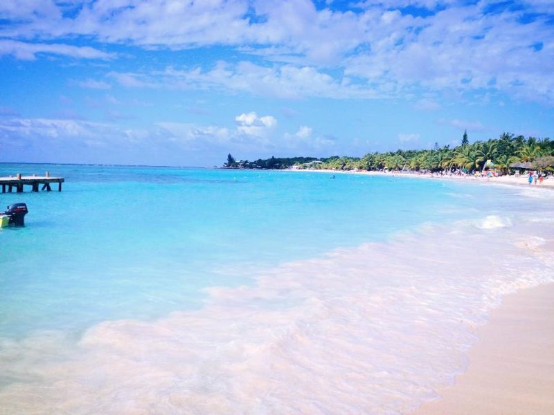
Roatán
Island · Bay Islands Department
Roatán is an island in the Caribbean, about 65 kilometres (40 mi) off the northern coast of Honduras. The largest of the Bay Islands of Honduras, it is located between the islands of Utila and Guanaja.
Text: Wikipedia (CC BY-SA 4.0). Photo: Westbrowncanada (CC BY-SA 3.0). Map

La Ceiba
City · Atlántida Department
La Ceiba is a municipality, the capital of the Honduran department of Atlántida and a port city on the northern coast of Honduras in Central America. It is located on the southern edge of the Caribbean, forming part of the south eastern boundary of the Gulf of Honduras.
Text: Wikipedia (CC BY-SA 4.0). Photo: Wikimedia Commons: La Ceiba.JPG (CC BY-SA 3.0). Map

Comayagua
City · Comayagua Department
Comayagua is a city, municipality and old capital of Honduras, located 80 km (50 mi) northwest of Tegucigalpa on the highway to San Pedro Sula and 594 m (1,949 ft) above sea level.
Text: Wikipedia (CC BY-SA 4.0). Photo: Luis Alfredo Romero (CC BY-SA 4.0). Map

Utila
Island · Bay Islands Department
Utila is the smallest of Honduras' major Bay Islands, after Roatán and Guanaja, in a region that marks the south end of the Mesoamerican Barrier Reef System, the second-largest in the world. It has been documented in history since Columbus' fourth voyage.
Text: Wikipedia (CC BY-SA 4.0). Photo: Rythie (CC BY 3.0). Map
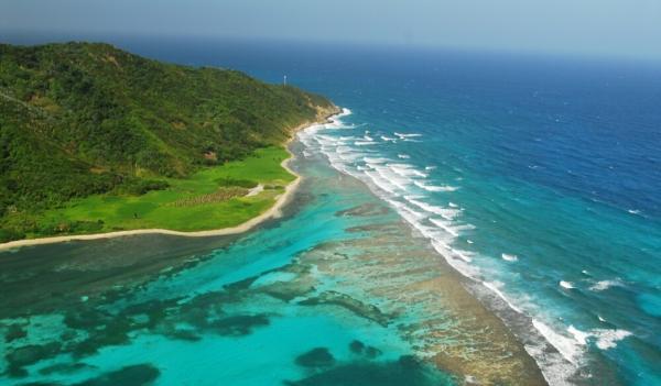
Guanaja
Island · Bay Islands Department
Guanaja is one of the Bay Islands of Honduras and is in the Caribbean. It is about 70 kilometres (43 mi) off the north coast of Honduras, and 12 kilometres (7.5 mi) from the island of Roatan.
Text: Wikipedia (CC BY-SA 4.0). Photo: Denise Clarke (CC BY-SA 2.0). Map

Cabo Gracias a Dios
Viewpoint · Gracias a Dios Department
Cabo Gracias a Dios, known in Miskito as Kip Almuk, is a prominent headland and river delta situated at the midpoint of the eastern coast of Central America, marking the geographical apex of the Mosquito Coast. It is the point where the Coco River flows into the Caribbean Sea.
Text: Wikipedia (CC BY-SA 4.0). Photo: Wikimedia Commons: Cape Gracias a Dios.jpg (Public domain). Map


Tiger Island
Isla del Tigre
Island · Valle Department
El Tigre is an island located in the Gulf of Fonseca, a body of water on the Pacific coast of Central America. The island is a conical basaltic stratovolcano and the southernmost volcano in Honduras. It belongs to Valle department.
Text: Wikipedia (CC BY-SA 4.0). Photo: Alfredobi (Public domain). Map


A few words in Spanish
From VoyaKin’s free Spanish lessons in the app, with audio there.
- HolaHello / Hi
- Buenos díasGood morning
- Buenas tardesGood afternoon
- Buenas nochesGood evening / Good night
- ¿Cómo está?How are you? (polite)
- Bien, gracias. ¿Y usted?Fine, thanks. And you?
- AdiósGoodbye
- Hasta luegoSee you later / Bye
Keep exploring
Also in Central America: Mexico · Costa Rica · Belize · El Salvador · Guatemala · Nicaragua · Panama
Last updated November 12, 2026. Sources: Wikipedia (CC BY-SA 4.0), Wikimedia Commons, OpenStreetMap (ODbL). Partner offers below are separate from this guide and never change what’s written here.
Plan & book Honduras
Partner linksVoyaKin may earn a commission if you book through a partner link. It doesn’t change your price. How we work with partners
Flights
Kiwi.com
Search flights on Kiwi.com
Compare routes to and from this country.
Partner link. VoyaKin may earn a commission if you book through this link, at no extra cost to you.
Tours & experiences
 48 hAdvanced Open Water Course 5.0 (78)From US$475 on Viator
 5 hGoodman's Island Style Roatan Highlights Tour 5.0 (72)From US$50 on Viator
 2 h–3 hChocolate Making Class at the Roatan Chocolate Factory in West End 5.0 (62)From US$105 on Viator
 4 h–5 hRoatan Sloth and Monkey Sanctuary with West Bay Beach Break 5.0 (55)From US$79 on Viator
 3.5 hRoatan Honduras Private Tour With Island Highlights 5.0 (52)From US$55 on Viator
 4 hRoatan Reef snorkeling and tour. 5.0 (52)From US$75 on Viator
 3 hMonkey/Sloth Park + Zipline And City Tour In Roatan 5.0 (43)From US$90 on Viator
 1.5 hRoatan Night Snorkel Adventure 5.0 (37)From US$70 on Viator
 4 hRoatan Snorkeling Shore Excursion Sanctuary Park and Beach Break 5.0 (32)From US$100 on Viator
 3 h–6 hRoatan Let's Plan your Day 5.0 (31)From US$65 on Viator
Partner links via Viator. Ratings, reviews and prices come from Viator and may change. VoyaKin may earn a commission if you book through a partner link. It doesn’t change your price.
eSIM & staying connected
Saily
Stay connected: get an eSIM before you fly.
VoyaKin travelers get US$5 off their first Saily plan with code VOYAKIN9122.
VoyaKin readers’ code
Partner link. VoyaKin may earn a commission if you book through this link, at no extra cost to you.
Partner linksVoyaKin may earn a commission if you book through a partner link. It doesn’t change your price. How we work with partners