Travel Hub
Plan a trip to Congo (DRC)

Congo (DRC) at a glance
Congo (DRC) is a country in Middle Africa; its capital is Kinshasa. People mainly speak French. The currency is the Congolese Franc (CDF). VoyaKin maps 20 places to see here, including 2 UNESCO World Heritage sites.
- Flag
- 🇨🇩
- Capital
- Kinshasa
- Region
- Middle Africa
- Languages
- French
- Currency
- Congolese Franc (CDF)
- More
- Wikidata
Before you go: official information
Entry rules, visas and health requirements change. Confirm them with Congo (DRC)’s official immigration authority or its embassy before you book and again before you travel.
Check your own government’s travel advice before you go.
Places to see in Congo (DRC)
12 of the 20 places VoyaKin maps here. Descriptions from Wikipedia and photos from Wikimedia Commons, credited on each card.
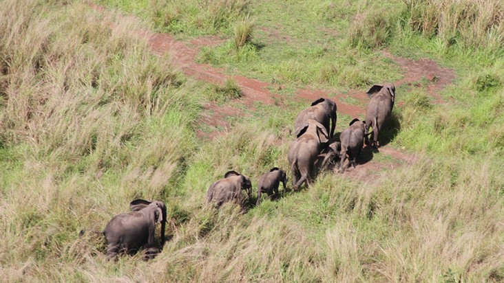
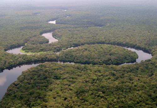
Salonga National ParkUNESCO
Parc national de la Salonga
Park & nature · Équateur
Salonga National Park is a national park in the Democratic Republic of the Congo located in the Congo River basin. It is Africa's largest tropical rainforest reserve covering about 36,000 km2 or 3,600,000 hectares. It extends into the provinces of Mai Ndombe, Equateur, Kasaï and Sankuru.
Text: Wikipedia (CC BY-SA 4.0). Photo: Radio Okapi (CC BY 2.0). Map
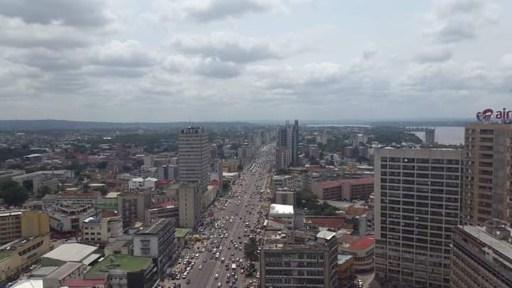
Kinshasa
City · Kinshasa
Kinshasa, formerly named Léopoldville from 1881 to 1966, is the capital and largest city of the Democratic Republic of the Congo. Kinshasa is one of the world's fastest-growing megacities, with an estimated population of 18.5 million in 2026.
Text: Wikipedia (CC BY-SA 4.0). Photo: Garcia-Pavilion (CC BY-SA 4.0). Map

Lake Kivu
Lake · Western Province
Lake Kivu is one of the African Great Lakes. It lies on the border between the Democratic Republic of the Congo and Rwanda, and is in the Albertine Rift, the western branch of the East African Rift. Lake Kivu empties into the Ruzizi River, which flows southwards into Lake Tanganyika.
Text: Wikipedia (CC BY-SA 4.0). Photo: Omirambe (CC BY-SA 4.0). Map

Lubumbashi
City · Haut-Katanga Province
Lubumbashi, formerly Élisabethville, is the second-largest city in the Democratic Republic of the Congo, located in the southeasternmost part of the country, near the border with Zambia.
Text: Wikipedia (CC BY-SA 4.0). Photo: T. Thielemans (CC BY 3.0). Map

Kisangani
City · Tshopo
Kisangani, formerly Stanleyville, is the capital of Tshopo Province, located on the Congo River in the eastern part of the central Congo Basin in the Democratic Republic of the Congo.
Text: Wikipedia (CC BY-SA 4.0). Photo: Piet Clement (CC BY-SA 3.0). Map

Lake Albert
Lac Albert / Lake Albert
Lake · Hoima
Lake Albert, originally known as Lake Mwitanzige by the Banyoro, Nam Ovoyo Bonyo by the Alur, and temporarily as Lake Mobutu Sese Seko, is a lake located in Uganda and the Democratic Republic of the Congo. It is Africa's sixth-largest lake and the second biggest of Uganda's Great Lakes.
Text: Wikipedia (CC BY-SA 4.0). Photo: Ndalilo koli (CC BY-SA 4.0). Map

Mbuji-Mayi
City · Kasaï-Oriental
Mbuji-Mayi is a city and the capital of Kasai-Oriental Province in the south-central Democratic Republic of Congo. It is thought to be the second largest city in the country, after the capital Kinshasa and ahead of Lubumbashi, Kisangani and Kananga, though its exact population is not known.
Text: Wikipedia (CC BY-SA 4.0). Photo: MONUSCO/Myriam Asmani (CC BY-SA 2.0). Map

Boyoma Falls
Chutes Wagenya
Waterfall · Tshopo
Boyoma Falls, formerly known as Stanley Falls, is a series of seven cataracts, each no more than 5 m (16 ft) high, extending over more than 100 km (62 mi) along a curve of the Lualaba River between the river port towns of Ubundu and Kisangani in the Orientale Province of the Democratic Republic of…
Text: Wikipedia (CC BY-SA 4.0). Photo: Ad Meskens (CC BY-SA 3.0). Map

Inga dams
Inga1 dam
Landmark · Kongo Central
The Inga Dams are two hydroelectric dams connected to one of the largest waterfalls in the world, Inga Falls. They are located in the western Democratic Republic of the Congo and 140 miles southwest of Kinshasa.
Text: Wikipedia (CC BY-SA 4.0). Photo: Alaindg (CC BY 2.5). Map

Lomami National Park
Parc national de la Lomami
Park & nature · Maniema
Lomami National Park is a national park located in the Democratic Republic of the Congo in Central Africa. Situated within the centre basin of the Lomami River, it straddles the Provinces of Tshopo and Maniema, with a slight overlap into the forests of the Tshuapa and Lualaba River basins.
Text: Wikipedia (CC BY-SA 4.0). Photo: Terese Hart (CC BY-SA 1.0). Map

Upemba National Park
Parc national de l'Upemba
Park & nature · Haut-Katanga Province
Upemba National Park is a large national park in Haut-Lomami, Lualaba Province & Haut-Katanga Province of the southeastern Democratic Republic of Congo, formerly Zaire.
Text: Wikipedia (CC BY-SA 4.0). Photo: NASA/Crew of STS-57 (Public domain). Map


Keep exploring
Also in Middle Africa: Angola · Cameroon · Central African Republic · Chad · Congo (Republic) · Equatorial Guinea · Gabon · São Tomé & Príncipe
Last updated November 12, 2026. Sources: Wikipedia (CC BY-SA 4.0), Wikimedia Commons, OpenStreetMap (ODbL). Partner offers below are separate from this guide and never change what’s written here.
Plan & book Congo (DRC)
Partner linksVoyaKin may earn a commission if you book through a partner link. It doesn’t change your price. How we work with partners
Flights
Kiwi.com
Search flights on Kiwi.com
Compare routes to and from this country.
Partner link. VoyaKin may earn a commission if you book through this link, at no extra cost to you.
eSIM & staying connected
Saily
Stay connected: get an eSIM before you fly.
VoyaKin travelers get US$5 off their first Saily plan with code VOYAKIN9122.
VoyaKin readers’ code
Partner link. VoyaKin may earn a commission if you book through this link, at no extra cost to you.
Partner linksVoyaKin may earn a commission if you book through a partner link. It doesn’t change your price. How we work with partners