Travel Hub
Plan a trip to Antarctica
Antarctica at a glance
Antarctica is a territory in Outlying Oceania. VoyaKin maps 20 places to see here.
- Flag
- 🇦🇶
- Region
- Outlying Oceania
- More
- Wikidata
Before you go: official information
Entry rules, visas and health requirements change. Confirm them with Antarctica’s official immigration authority or its embassy before you book and again before you travel.
Check your own government’s travel advice before you go.
Places to see in Antarctica
12 of the 20 places VoyaKin maps here. Descriptions from Wikipedia and photos from Wikimedia Commons, credited on each card.

Vinson Massif
Mount Vinson
Mountain
Vinson Massif is a large mountain massif in Antarctica that is 21 km (13 mi) long and 13 km (8 mi) wide and lies within the Sentinel Range of the Ellsworth Mountains. It overlooks the Ronne Ice Shelf near the base of the Antarctic Peninsula.
Text: Wikipedia (CC BY-SA 4.0). Photo: Christian Stangl (CC BY-SA 2.0). Map
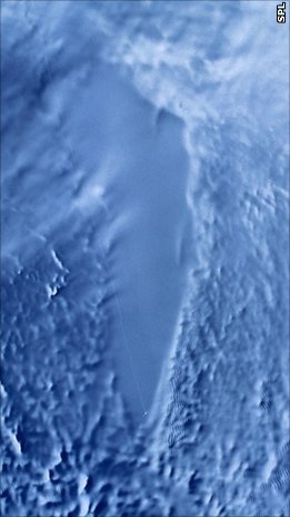
Lake Vostok
Озеро Восто́к
Lake
Lake Vostok is the largest of Antarctica's 675 known subglacial lakes and the 16th largest lake in the world by area.
Text: Wikipedia (CC BY-SA 4.0). Photo: Goddard Space Flight Center (Public domain). Map
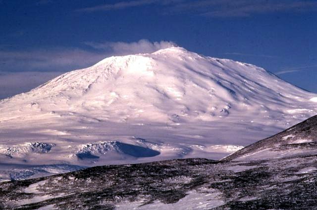
Mount Erebus
Mountain
Mount Erebus is the southernmost active volcano on Earth, located on Ross Island in the Ross Dependency in Antarctica. With a summit elevation of 3,792 metres (12,441 ft), it is the second most prominent mountain in Antarctica and the second-highest volcano in Antarctica.
Text: Wikipedia (CC BY-SA 4.0). Photo: Richard Waitt, U.S. Geological Survey (Public domain). Map

McMurdo Station
Town
McMurdo Station is an American Antarctic research station on the southern tip of Ross Island. It is operated by the United States through the United States Antarctic Program (USAP), a branch of the National Science Foundation (NSF).
Text: Wikipedia (CC BY-SA 4.0). Photo: Gaelen Marsden (CC BY-SA 3.0). Map

Blood Falls
Waterfall
Blood Falls is an outflow of an iron(III) oxide–tainted plume of saltwater, flowing from the tongue of Taylor Glacier onto the ice-covered surface of West Lake Bonney in the Taylor Valley of the McMurdo Dry Valleys in Victoria Land, East Antarctica.
Text: Wikipedia (CC BY-SA 4.0). Photo: National Science Foundation/Peter Rejcek (Public domain). Map

Ross Island
Island
Ross Island is an island in Antarctica lying on the east side of McMurdo Sound and extending 43 nautical miles from Cape Bird in the north to Cape Armitage in the south, and a similar distance from Cape Royds in the west to Cape Crozier in the east. The island is entirely volcanic.
Text: Wikipedia (CC BY-SA 4.0). Photo: Alan Light (CC BY 2.0). Map

Elephant Island
Island
Elephant Island is an ice-covered, mountainous island off the coast of Antarctica in the outer reaches of the South Shetland Islands, in the Southern Ocean.
Text: Wikipedia (CC BY-SA 4.0). Photo: David Stanley from Nanaimo, Canada (CC BY 2.0). Map
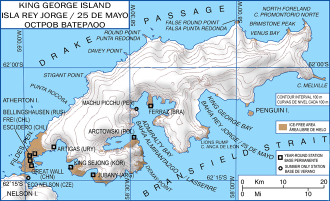
King George Island
Island
King George Island is the largest of the South Shetland Islands, lying 120 km off the coast of Antarctica in the Southern Ocean. The island was named after King George III.
Text: Wikipedia (CC BY-SA 4.0). Photo: Giovanni Fattori (CC BY-SA 3.0). Map

Mount Takahe
Mountain
Mount Takahe is a 3,460-metre-high (11,350 ft) snow-covered shield volcano in Marie Byrd Land, Antarctica, 200 kilometres (120 mi) from the Amundsen Sea. It is a c. 30-kilometre-wide (19 mi) mountain with parasitic vents and a caldera up to 8 kilometres (5 mi) wide.
Text: Wikipedia (CC BY-SA 4.0). Photo: US Navy (Public domain). Map
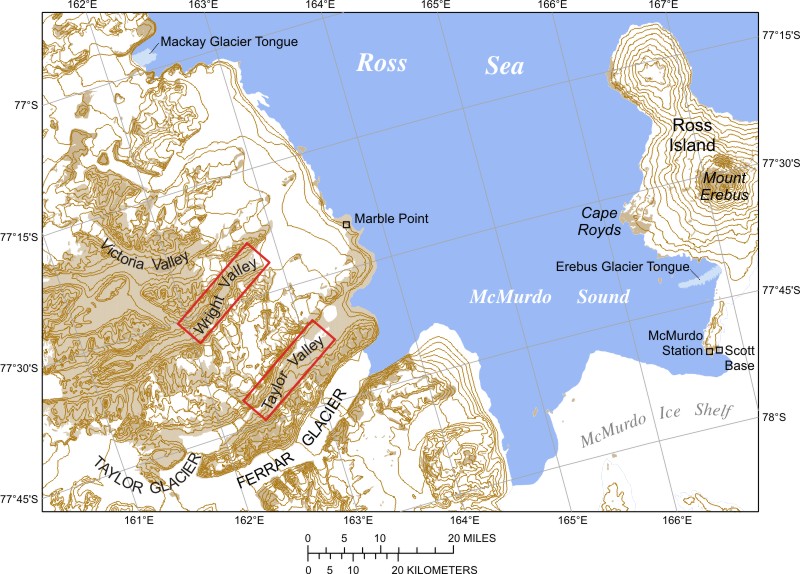

Mount Terror
Mountain
Mount Terror is an extinct volcano about 3,230 metres (10,600 ft) high on Ross Island, Antarctica, about 20 nautical miles eastward of Mount Erebus. Mount Terror was named in 1841 by polar explorer James Clark Ross after his second ship, HMS Terror.
Text: Wikipedia (CC BY-SA 4.0). Photo: John Bortniak, NOAA (Public domain). Map

Cape Adare
Viewpoint
Cape Adare is a prominent cape of black basalt forming the northern tip of the Adare Peninsula and the north-easternmost extremity of Victoria Land, East Antarctica.
Text: Wikipedia (CC BY-SA 4.0). Photo: United States Geological Survey (Public domain). Map


Keep exploring
Last updated November 12, 2026. Sources: Wikipedia (CC BY-SA 4.0), Wikimedia Commons, OpenStreetMap (ODbL). Partner offers below are separate from this guide and never change what’s written here.
Plan & book Antarctica
Partner linksVoyaKin may earn a commission if you book through a partner link. It doesn’t change your price. How we work with partners
Flights
Kiwi.com
Search flights on Kiwi.com
Compare routes to and from this country.
Partner link. VoyaKin may earn a commission if you book through this link, at no extra cost to you.
eSIM & staying connected
Saily
Stay connected: get an eSIM before you fly.
VoyaKin travelers get US$5 off their first Saily plan with code VOYAKIN9122.
VoyaKin readers’ code
Partner link. VoyaKin may earn a commission if you book through this link, at no extra cost to you.
Partner linksVoyaKin may earn a commission if you book through a partner link. It doesn’t change your price. How we work with partners